Tag Archive | "2011"

Tags: , , , ,

FLICKS: Sherlock Holmes and 2011 memories

Posted on 29 December 2011 by LeslieM

By Dave Montalbano

AdventuresOfCinemaDave.com

While the story and characters are as interesting as the first movie, Sherlock Holmes: A Game of Shadows does not hold up as well as the original film.  Robert Downey Jr., Jude Law and Kelly Reilly reprise their roles with relish. While Noomi Ropace (the original Girl with the Dragon Tattoo) adds dimension to author Sir Arthur Conan Doyle’s world, the attention deficit disorder editing distracts from the action sequences.

Still, Director Guy Ritchie deserves credit for providing an interesting film that will satisfy both modern audiences and diehard fans. Like the first film, the organic musical score is a highlight. During a mountain trek, one can hear the theme song from Two Mules for Sister Sarah, which creates a subconscious link between Sherlock Holmes and the American cowboy.

Comments Off on FLICKS: Sherlock Holmes and 2011 memories

Tags: , , , , , , , , , , , , , , , , , , , , , , , , , , , , , , , , , , , , , ,

Crabby Jack’s fire; 2nd restaurant to burn in Rivertowne Square this month

Posted on 28 August 2011 by JLusk

Crabby Jacks, at 1015 S.  Federal, in Deerfield Beach,  is the second restaurant this month in Rivertowne Square shopping center at SW 10th and Federal to have a fire.

People cruising by Sunday morning watched as it was burning down between 6:40 and 7:00 a.m. before someone finally called the fire in. Deerfield started rolling on the call at 7 a.m. and quickly called for back up from Pompano and Ft. Lauderdale.

There was a rumor going around town that maybe there was a “firebug” in the area because of a fire at Peking Tokyo Buffet on Aug. 12, which is still closed, less than a 1000 feet from Crabby Jack’s. That fire was a result of grease build up on and around the grill so when the employee fired it up there was a flash fire.

Quitoni from Deerfield fire said it took about 30 minutes to whack down the initial blaze.  BSO cleared out Denny’s next door because it was so hot.  Onlookers were coming by all day. The state Fire Marshall is investigating the fire and we should have an answer soon.

We will have the complete story in our Sept 1 issue of the Observer. To watch video of the Peking Tokyo Buffet fire on Aug 12 and the Crabby Jack’s fire go to ObserverTV and click on” latest videos”

PHOTO BY JEFF GRAVES


Comments Off on Crabby Jack’s fire; 2nd restaurant to burn in Rivertowne Square this month

Tags: , , , , , , , ,

Fifth named storm brings South Florida into the cone

Posted on 02 August 2011 by LeslieM

SATELLITE IMAGES REVEAL THAT THE CLOUD PATTERN IS A LITTLE BETTER
ORGANIZED THAN YESTERDAY WHEN THERE WAS AN EXPOSED LOW LEVEL
CENTER. TODAY THE CENTER IS WELL EMBEDDED IN THE CONVECTION WITH
CYCLONICALLY CURVED CONVECTIVE BANDS...A POSSIBLE CENTRAL DENSE
OVERCAST...AND MORE SIGNIFICANTLY...THE OUTFLOW HAS BECOME
ESTABLISHED IN ALL QUADRANTS. HOWEVER...DATA FROM THE
RECONNAISSANCE AIRCRAFT EARLIER THIS MORNING SUGGEST THAT THE WINDS
REMAIN AT 45 KNOTS AND THE CENTRAL SURFACE PRESSURE IS STEADY. 

THE INTENSITY FORECAST IS MORE COMPLEX THAN USUAL. THE CYCLONE IS
FORECAST TO INTERACT WITH THE HIGH TERRAIN OF HISPANIOLA AND
EASTERN CUBA AND THAT IMPLIES WEAKENING. IN ADDITION...GLOBAL
MODELS WEAKEN OR DISSIPATE THE CYCLONE...AND OBVIOUSLY THESE MODELS
CAN DETECT AN UNFAVORABLE ENVIRONMENT THAT IS NOT APPARENT TO ME.
THIS MAKES IT DIFFICULT TO FORECAST INTENSIFICATION WITH SUCH
INDICATIONS FROM THE RELIABLE GUIDANCE. ON THE OTHER HAND...SHIPS
AND THE GFDL/HWRF MODEL PAIR INTENSIFY THE CYCLONE. GIVEN THIS HIGH
DEGREE OF UNCERTAINTY...THE OFFICIAL FORECAST CALLS FOR NO
SIGNIFICANT CHANGE IN INTENSITY...OR PERHAPS FOR A SLIGHT WEAKENING
AS THE CYCLONE MOVES BY HAITI AND CUBA DURING THE NEXT 24 HOURS.
SOME RE-INTENSIFICATION IS POSSIBLE ONCE EMILY REACHES THE AREA OF
THE BAHAMAS. 

SATELLITE AND RECONNAISSANCE PLANE FIXES INDICATE THAT EMILY IS
MOVING TOWARD THE WEST-NORTHWEST OR 285 DEGREES AT 4 KNOTS.  GLOBAL
MODELS CONTINUE TO SHOW A WEAKNESS IN THE SUBTROPICAL RIDGE AND A
TROUGH ALONG THE EAST COAST OF THE UNITED STATES. THIS PATTERN
FAVORS A TURN TO THE NORTHWEST WITHIN THE NEXT 12 TO 24 HOURS WITH
A GRADUAL TURN TO THE NORTH AND NORTHEAST BETWEEN 48 AND 72 HOURS.
IT IS UNCERTAIN HOW FAR WEST EMILY WILL REACH BEFORE RECURVATURE...
PRIMARILY GIVEN THAT GLOBAL MODELS WEAKEN OR DISSIPATE THE CYCLONE.
THE OFFICIAL FORECAST TRACK KEEPS THE CENTER OF EMILY WELL OFF THE
EAST COAST OF FLORIDA...AND GIVEN THE SMALL TROPICAL STORM FORCE
WIND RADII ON THE WESTERN SIDE OF THE CYCLONE...A TROPICAL STORM
WATCH FOR THE FLORIDA SOUTHEAST COAST IS NOT REQUIRED AT THIS TIME.

Comments Off on Fifth named storm brings South Florida into the cone

Tags: , , , , , , , , , ,

2011 Relay for Life Wrap-Up Party Tuesday June 21

Posted on 20 June 2011 by LeslieM

RELAY FOR LIFE OF DEERFIELD BEACH/LIGHTHOUSE POINT
Join the Relay teams as they wrap up the 2011 Relay For Life. Committee Members, Team Captains and Members, Survivors . . . everyone is invited. There will be food, cash bar, fun, awards, and prizes (lots of prizes) as we look back on 2011 and forward to 2012.

Tuesday, June 21st , 7 – 9 PM
Hilton of Deerfield Beach (Hillsboro and I-95)
Hilton is kindly donating the light hors d’oeuvres and room for us, so we would appreciate an RSVP to TJ – tjego2@aol.com,
Gordon – printingxcetera@aol.com, or Nona – nonabreit@gmail.com

Be sure to bring any monies you have not yet turned in and register your team for next year

Comments Off on 2011 Relay for Life Wrap-Up Party Tuesday June 21

Tags: , , , , , , , ,

NOAA predicting above-average hurricane season

Posted on 01 June 2011 by LeslieM

Hurricanes Karl, Igor and Julia (from left to right on Sept. 16) were part of the onslaught of Atlantic storms last hurricane season (2010). (Photo credit: NOAA)

The Atlantic basin is expected to see an above-normal hurricane season this year, according to the seasonal outlook issued by NOAA’s Climate Prediction Center – a division of the National Weather Service.

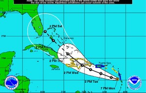
Across the entire Atlantic Basin for the six-month season, which begins June 1, NOAA is predicting the following ranges this year:

  • 12 to 18 named storms (winds of 39 mph or higher), of which:
  • 6 to 10 could become hurricanes (winds of 74 mph or higher), including:
  • 3 to 6 major hurricanes (Category 3, 4 or 5; winds of 111 mph or higher)

Each of these ranges has a 70 percent likelihood, and indicate that activity will exceed the seasonal average of 11 named storms, six hurricanes and two major hurricanes.

“The United States was fortunate last year. Winds steered most of the season’s tropical storms and all hurricanes away from our coastlines,” said Jane Lubchenco, Ph.D., under secretary of commerce for oceans and atmosphere and NOAA administrator. “However we can’t count on luck to get us through this season. We need to be prepared, especially with this above-normal outlook.”

Climate factors considered for this outlook are:

  • The continuing high activity era. Since 1995, the tropical multi-decadal signal has brought ocean and atmospheric conditions conducive for development in sync, leading to more active Atlantic hurricane seasons.
  • Warm Atlantic Ocean water. Sea surface temperatures where storms often develop and move across the Atlantic are up to two degrees Fahrenheit warmer-than-average.
  • La Niña, which continues to weaken in the equatorial Pacific Ocean, is expected to dissipate later this month or in June, but its impacts such as reduced wind shear are expected to continue into the hurricane season.

“In addition to multiple climate factors, seasonal climate models also indicate an above-normal season is likely, and even suggest we could see activity comparable to some of the active seasons since 1995,” said Gerry Bell, Ph.D., lead seasonal hurricane forecaster at NOAA’s Climate Prediction Center.

NOAA’s seasonal hurricane outlook does not predict where and when any of these storms may hit. Landfall is dictated by weather patterns in place at the time the storm approaches. For each storm, NOAA’s National Hurricane Center forecasts how these weather patterns affect the storm track, intensity and landfall potential.

“The tornadoes that devastated the South and the large amount of flooding we’ve seen this spring should serve as a reminder that disasters can happen anytime and anywhere. As we move into this hurricane season it’s important to remember that FEMA is just part of an emergency management team that includes the entire federal family, state, local and tribal governments, the private sector and most importantly the public,” said FEMA Administrator Craig Fugate.

“Now is the time, if you haven’t already, to get your plan together for what you and your family would do if disaster strikes. Visit ready.gov to learn more. And if you’re a small business owner, visit www.ready.gov/business to ensure that your business is prepared for a disaster,” added Fugate.

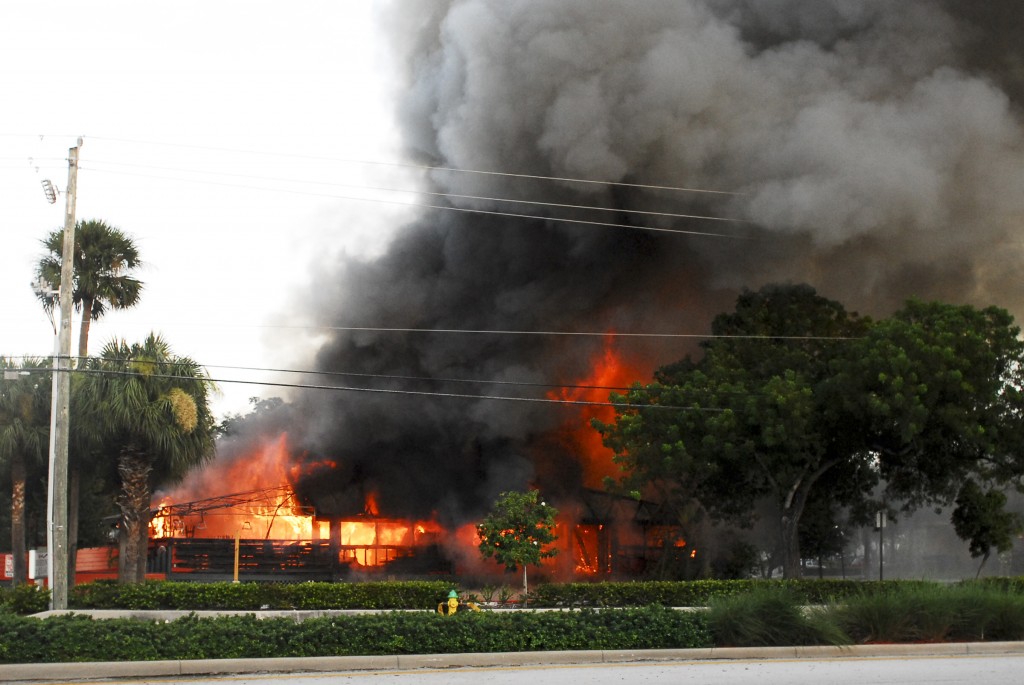
Hurricane impacts are not limited to the coastline; strong winds and flooding rainfall often pose a threat across inland areas along with the risk for tornadoes.

May 22-28 was national Hurricane Preparedness Week. To help prepare residents of hurricane-prone areas, NOAA is unveiling a new set of video and audio public service announcements featuring NOAA hurricane experts and the FEMA administrator that are available in both English and Spanish. These are available at http://www.hurricanes.gov/prepare.

The National Weather Service is the primary source of weather data, forecasts and warnings for the United States and its territories. It operates the most advanced weather and flood warning and forecast system in the world, helping to protect lives and property and enhance the national economy. Visit us online at weather.gov and on Facebook.

NOAA’s mission is to understand and predict changes in the Earth’s environment, from the depths of the ocean to the surface of the sun, and to conserve and manage our coastal and marine resources. Visit us on Facebook.

Comments Off on NOAA predicting above-average hurricane season

Advertise Here
Advertise Here